How can you navigate a city when you don’t speak the language?
Navigating Olympic Tokyo
What We Did
The Context
This goal fits with broader plans for the future of the city. The Tokyo Metropolitan Government has set a plan in motion, “Creating the Future: The Long-Term Vision for Tokyo,” that envisions a city that can be easily navigated by multilingual visitors. The government’s aspirations go well beyond wayfinding—they also hope to become a city that is resilient from natural and man-made disasters and acts of terrorism, including measures for disaster preparedness, counterterrorism, and hospitality. We believe an improved urban navigation and communications system can address goals not only of greater hospitality and navigation, but also can improve the city’s overall resilience and preparedness.
The Results
For confused travelers, offering navigational information in multiple scales can ease anxiety and instill a sense of confidence as they navigate a new city. For residents, multiscaled wayfinding allows the public to keep informed when city and regional announcements are broadcast to the system.
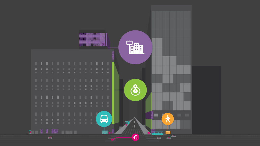
We propose design interventions across five distinct scales within the existing built environment: XS (personal scale) S (pedestrian scale) M (street scale) L (district scale) XL (city scale)
Each scale can serve dual purposes: to provide a simple and clear navigation and information source during the Olympic Games, and to improve resilience after the games by providing vital information during emergency evacuations. By connecting across scales, navigational infrastructure has the potential to provide a seamless experience, reducing stress for those who need information anytime and anywhere.
What This Means
Create a multi-language navigation “app” that Tokyo residents and Olympic visitors can download that feeds interactive information to their smartphones and tablets. This could potentially integrate augmented reality, real-time information, and translation of users’ surroundings, powered by an icon-based, intuitive search engine. Rather than changing existing signage to be multilingual, this navigation system could instead change the way users read them.
Pedestrian Scale: Making vending machines wayfinding and disaster relief tools.
Japan has the highest ratio of vending machines to landmass in the world, with more than 5.5 million machines nationwide. Together, they can hold three days’ worth of water and other beverages for the entire population of Japan. During the Olympics, high-tech vending machines with digital displays can serve as dual-purpose information centers for the games and as a source for free Wi-Fi. When the games end, they can serve as community message boards and communicate real-time disaster relief information when necessary, while also dispensing emergency kits, food, and water for residents and visitors.
Screetscale: Repurpose bus stops as communication hubs.
Bus stops have long been a place for public advertising, and can be enhanced as a public utility to provide free Wi-Fi. During the Olympics, bus stops can be repurposed as small public viewing spots, broadcasting live events from nearby stadiums. They can also provide interactive maps for locating event details and planning transportation routes. In the case of a large-scale emergency, the large digital screens can be transformed to display evacuation routes.
District Scale: Integrate digital displays into building facades, convenience stores.
Digital displays installed on key building façades are capable of transmitting general information to the public, such as weather and traffic updates. They can also sync with mobile devices to provide directions to featured content, working across the scales described previously. Convenience stores in particular are an opportunity—Japan has more than 50,000 convenience stores, mainly concentrated in Tokyo, that could become an integral part of an enhanced navigational infrastructure.
City Scale: Install super-graphics at amjor intersections to broadcast to the masses.
Oversize graphic billboards and digital displays are common throughout Tokyo. During the Olympics, they can become major public viewing spaces. For example, more than 500,000 people cross the famous Shibuya Crossing every day, resulting in millions of impressions per day for its surrounding displays. In the case of a major regional emergency, large-scale digital signage— including those at Shibuya Crossing—can become a critical place to provide disaster relief information quickly to a broader audience.
What’s Next?
Learn More
Comments or ideas for further questions we should investigate?
